|
|
|
Salak Phet Bay
|
Travel Guide for Salak Phet Bay
|
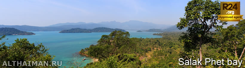
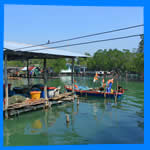
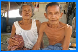 Salak Phet bay you will find in south-east of Koh Chang island and its dimensions are 3 km in length and from 1.5 to 2.5 km wide. In a picturesque bay surrounded by mountains three small islands lie - Koh Mapring island, Koh Phrao Nai and Koh Phrao Nok. There are three villages there: Ban Rong Than, Ban Salak Phet and Ban Chek Bae. Hoses of the islanders are right in the bay on stilts and residents live by fishing and farming, growing coconuts and rubber. Salak Phet bay you will find in south-east of Koh Chang island and its dimensions are 3 km in length and from 1.5 to 2.5 km wide. In a picturesque bay surrounded by mountains three small islands lie - Koh Mapring island, Koh Phrao Nai and Koh Phrao Nok. There are three villages there: Ban Rong Than, Ban Salak Phet and Ban Chek Bae. Hoses of the islanders are right in the bay on stilts and residents live by fishing and farming, growing coconuts and rubber.
On the roadside of 500 metres North of Ban Salak Phet village is a small hospital which is open from 08.30 - 16.30. Nearby you will find the police station.
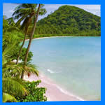
To south-east from Salak Phet village there are two beaches: Long Beach and another beach smaller with Naval Shrine in honor of victims the naval battles 1941. Approximately 2 km north-east from Ban Salak Phet in the depths of the forest, Khiri Phet Waterfall is located, the top of it offer stunning bay's views.
Getting to Salak Phet Bay can on Koh Chang main road via est coast by taxi. The best way to see this beautiful bay is to rent a motorbike, stock up Koh Chang map and go on a personal journey. By motorbike ride south along Koh Chang East coast and will get Salak Phet Bay. |
| |
| |
| |
|
|
|
| |
 Salak Phet bay Map Salak Phet bay Map |
|
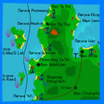 Our interactive detailed Koh Chang map showing all hotels, their exact location on the island, as well as the surrounding roads, restaurants, bars, attractions and useful landmarks. Koh Chang Maps is the fastest way to choosing your vacation spot in Koh Chang island. Our interactive detailed Koh Chang map showing all hotels, their exact location on the island, as well as the surrounding roads, restaurants, bars, attractions and useful landmarks. Koh Chang Maps is the fastest way to choosing your vacation spot in Koh Chang island.
 Read more... Read more... |
| |
|
|
|
|
|